
Reach 2 - Upstream Project
The Reach 2 - The “Upstream” or “Urban Reach” Project.
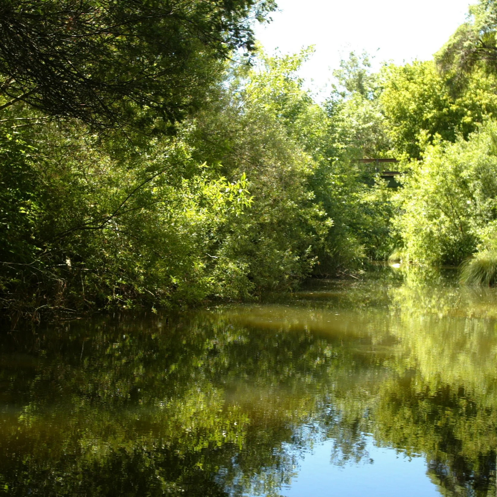
The SFCJPA’s projects use the term “Reach” to describe a specific segment of the San Francisquito Creek, or the Bay shoreline. In the case of the Reach 2 project, this describes the area of the Creek from where Middlefield Road crosses the creek, downstream to where Highway 101 crosses the creek.
The SFCJPA is the lead agency under the California Environmental Quality Act (CEQA) and has certified an Environmental Impact Report (EIR) for the Reach 2 “urban” project between Middlefield Road and Highway 101. The SFCJPA is the lead for planning and design, regulatory permitting, and in the future, for the construction of project elements in this reach.
Better instrumentation and technology was in place on 12/31/2022 than during the 1998 flood. The storm and resulting overtopping of the creek’s banks on 12/31/2022 provided more data about how the watershed and the creek behave during intense storms that was not previously available. This helped to re-calibrate the hydraulic model of the creek and adjust project planning accordingly. We have learned that the channel capacity is approximately 25% smaller than previously understood. That means the capacity of our project designs must scale up by that much, too.
Also, prior to the 2022 flood it was widely believed that the Pope-Chaucer bridge was the primary location of overbanking in this reach, but the creek overbanked at several locations upstream - and - downstream of the bridge. This new information suggests that modifications to the bridge will require larger than previously believed changes to the planned channel and/or bank-top work downstream and upstream of the bridge. The 2022 flood also demonstrated that changing weather patterns can have greater impacts over a short duration.
The Reach 2 project will likely consist of four components, each of which have independent utility but together provide for greater flood risk reduction and ecosystem restoration. Working from downstream to upstream, they include:
- Replace Newell Road Bridge
- Widen the channel at strategic locations
- Repair or replace existing old top-of-bank floodwalls
- Add floodwalls where needed.
- Replace the Pope-Chaucer Bridge
- Other solutions to expand channel capacity or detain flow may be evaluated.
The details of the channel widening and top-of-bank structures ("floodwalls") have not been finalized. The various combinations will be analyzed according to cost, impact, permit-ability, maintain-ability, and community preference, and a staff-recommended suite of project elements (the project 'alternative') will be presented to the Board for their consideration.
Lead: Caltrans, City of Palo Alto
The City of Palo Alto is leading the replacement of the Newell Road Bridge. Funded by Caltrans and Valley Water, the existing 1911 bridge, which has been categorized as functionally obsolete, will be replaced with a modern bridge that will improve traffic safety and allow for greater creek flow conveyance.
Construction Cost: $15.5 Million
Status: Site preparation is in progress, and construction is anticipated in 2026.
Newell Road/San Francisquito Creek Bridge Replacement Project – City of Palo Alto, CA
Final EIRARB approval drawingsProject information from a presentation given by Palo Alto staff to East Palo Alto City Council on June 19, 2019Lead: US Army Corps of Engineers (USACE) and SFCJPA
The Corps of Engineers is undertaking a Continuing Authorities Program (CAP) Section 205 study for the widening of strategic locations along the channel between Pope-Chaucer Bridge and Highway 101. The creek currently floods at or just upstream of these constriction points and would flood to a greater extent when more flow is allowed to flow down the channel if not modified.
For channel widening, the project is considering vertical sheet piles with underground tie-backs where space is limited for widening. In locations with more space to work, the bank will be laid back to a stable slope and vegetated with native species.
Lead: SFCJPA
Aging floodwalls are present along much of the top of the creek banks on both sides of the creek downstream of Newell Road. These structures must be repaired or replaced.
The temporary wooden floodwall along Woodland Ave. in East Palo Alto adjacent to the University Ave. bridge will be replaced with a permanent structure.
Additional floodwalls between Middlefield Rd. and Newell Rd are being evaluated. No design has been chosen, and size and location requirements are not yet clear. These details will be determined in the course of the design process, as we weigh the tradeoffs between widening and floodwalls.
Lead: SFCJPA
The Pope-Chaucer Bridge has an undersized culvert that backs up flow in large events and causes overtopping upstream of the bridge, but also details water and protects communities downstream. The bridge will be replaced to reduce flood risk upstream while additional project elements will need to be in place to protect communities downstream. Project elements downstream of the bridge will need to be completed first to prevent a transfer of risk.
June 5, 2025 Webinar Recording
June 5, 2025 Webinar Slide Presentation Webinar Q&A Responses WRA Slide Presentation, November 19, 2024, Board Meeting. San Francisquito Creek Hydrology, Geomorphology, and Some Potential Reach 2 Project Actions. Independent Review HEC-RAS Model, 2024 Errata page for Independent Review Memo Page 1 -3. Valley Water’s Final Draft Technical Memoranda on Stream Hydrology, June 2023.Project Description, Draft Arborist Report, and Plan Set for Pope-Chaucer Bridge, as provided to Palo Alto, Menlo Park and East Palo Alto, August 2020.
Project Description Draft Arborist Report Plan Set Menlo Park Heritage Tree Permit Application April 2021 Preliminary Arborist Report, April 2021 Revised Preliminary Arborist Report, April 15, 2021 Final EIR Upstream of Highway 101 - Volume 1. September 2019 Final EIR Upstream of Highway 101 - Volume 2 Appendices A - E. September 2019 Final EIR Upstream of Highway 101 - Volume 2 Appendices F - G. September 2019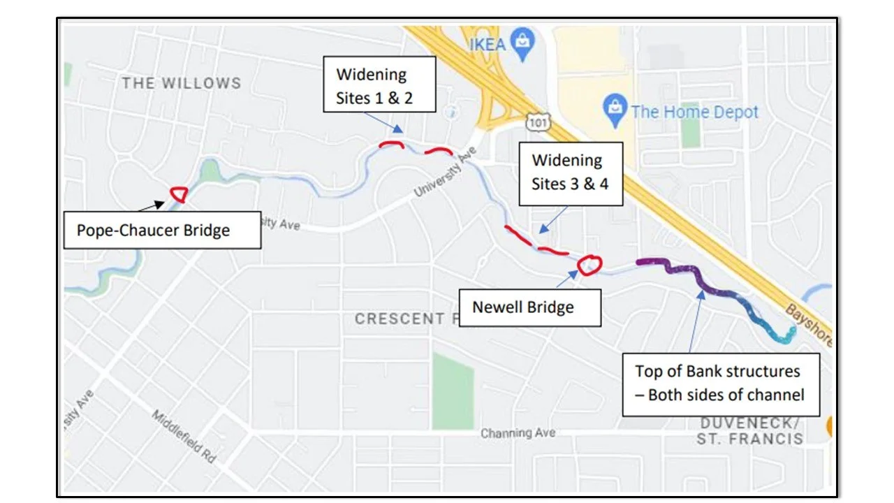
Frequently Asked Questions
Updated March 2024
The SFCJPA’s member agency, Valley Water, performed a detailed analysis of the creek’s behavior to understand why observed events did not correlate well with predicted results from the hydraulic model (HEC-RAS model). This model was used as the basis of design for the proposed Reach 2 Project components. This evaluation determined that the creek capacity was over estimated in the model- and that observed water surface elevations were up to two feet higher than predicted (Valley Water, June 2023). (Meaning that the channel is smaller, and will hold less water, than was previously understood.)
For more information see: Independent Review HEC-RAS Model, 2024 in the Project Documents section above.
The SFCJPA commissioned an independent evaluation of the HEC-RAS model, as well as an updated survey of the channel at locations of observed creek overtopping from the New Year’s Eve 2022 flood event. We also asked our consultant to review the USGS methodology of validating data at their stream gage in San Francisquito Creek located in Stanford’s Golf Course. The full analysis and evaluation can be found on the here:
For more information see: Valley Water’s Final Draft Technical Memoranda on Stream Hydrology, June 2023 in the Project Documents section above.
The New Year’s Eve 2022 event was the second highest flow in recorded history. During previous flood events monitoring instrumentation, observations, and flow models were not as detailed or complete as we have now. We learned that:
- An updated flood frequency analysis indicates that the New Years’ Eve storm was approximately a ‘30-year’ event.
- The channel has approximately 25% less capacity than we thought it had.
- We always understood that the Pope-Chaucer Bridge is a choke point and water spills upstream of the bridge – BUT - it also prevents a lot of trouble by restricting flow downstream, protecting certain areas of Menlo Park and East Palo Alto. So, we must be very careful with this part of the project to avoid making a bigger problem somewhere else (it is against the law to transfer risk.)
No. There have been rumors and inaccurate information circulating that Stanford has already removed the Searsville Dam, causing sediment or high flows during storms, that have caused flooding. This is wrong. Stanford University is considering how best to restore fish passage by creating a hole in the Searsville Dam. They are still working on their environmental analysis. The Searsville Dam is still in place. Nothing has changed. You can learn more about Stanford’s proposed project on their project website here: https://searsville.stanford.edu/
The potential exists for sediment that has accumulated behind the dam to reduce creek capacity downstream once the Searsville project is built. However, Stanford must mitigate sediment impacts as part of their project.
Stanford has already built plans for sediment traps in the upper watershed into their design.
No. Valley Water’s evaluation indicates that even if aggressively managed, removing vegetation will not be the solution to prevent flooding on the San Francisquito Creek. This was corroborated by the Independent Review.
The SFJCPA is drafting an invasive species management plan to help address some of the over-growth and this will help a little bit to maintain creek habitat and capacity - but vegetation is neither the cause of nor is its removal a solution to flooding along the creek.
The rights, and rules, of private property ownership limit what public agencies can do. Access to the creek is limited by a patchwork of private ownership and access easements with cities, counties, and other agencies. Typically, those easements are only for specific purposes, such as flood control feature maintenance.
A useful guide to creek bank restoration and maintenance, “The San Francisquito Creek Bank Stabilization and Revegetation Master Plan” is available on the SFCJPA Documents Archive, linked below.
Not as a stand-alone action - we must do what we can downstream first. We have some preliminary information about costs, and how we might design and build such a project. As we consider approaches and options for increasing flood protection, this may be explored in more detail.
Page updated on October 29, 2025